
Copernicus Crater
A prominent complex crater with terraced walls, central peaks and a bright ray system.
What you are looking at
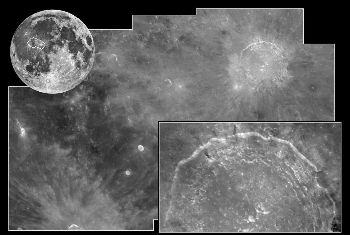
Copernicus is about 93 km wide. Its walls have collapsed into broad terraces, and several central peaks rise from the floor. Bright ejecta rays and secondary-crater chains extend into surrounding mare and highland terrain.
How it formed and changed
The crater formed on the boundary of Mare Imbrium and Oceanus Procellarum terrain. The impact excavated material from depth, exposing bedrock in the central uplift and spreading ejecta across older surfaces.
What scientists learn here
Copernicus gives geologists a clear example of the transition from excavation to gravitational collapse in a large complex crater. High-resolution LRO observations show fractured bedrock, boulder tracks and sharp rim textures that help constrain impact processes and relative age.
How to find and observe Copernicus Crater
Copernicus is one of the best telescopic craters. Around first-quarter to waxing-gibbous phases, low sunlight produces dramatic terrace and central-peak shadows. Near full Moon, its ray system becomes more prominent while topographic relief appears flatter.
Nearby landmarks and exploration context
The crater lies south of Mare Imbrium. Eratosthenes is to the east, while the Carpathian Mountains and mare plains provide contrasting terrain nearby.
Why this feature matters
Its well-defined structure makes Copernicus an excellent telescopic target for studying complex impact craters.