
Mare Tranquillitatis
A dark basaltic plain on the lunar near side best known as the region containing the Apollo 11 landing site.
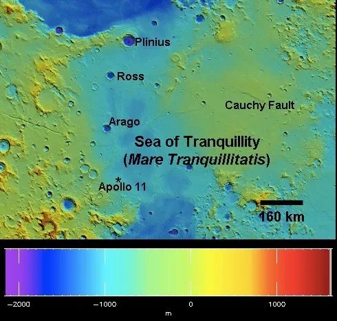
What you are looking at
Mare Tranquillitatis is a broad dark plain made of basaltic lava flows. Its smoother, lower-albedo surface contrasts strongly with the brighter, more heavily cratered highlands around it.
How it formed and changed
Large impacts created low terrain that was later flooded by multiple episodes of basaltic volcanism. Variations in basalt composition and age record changes in mantle melting and volcanic activity.
What scientists learn here
Apollo 11 samples supplied direct laboratory measurements of mare basalt and regolith from this region. Those samples helped calibrate remote sensing and provided radiometric ages that connect crater densities with absolute chronology.
How to find and observe Mare Tranquillitatis
The mare is easy to identify with the unaided eye as part of the dark near-side pattern. Binoculars reveal its boundaries; telescopes show small craters, wrinkle ridges and the transition into adjacent maria and highlands.
Nearby landmarks and exploration context
Mare Serenitatis lies to the north, Mare Fecunditatis to the east and Sinus Asperitatis toward the south-west. The Apollo 11 landing site lies in the south-western part of the mare.
Why this feature matters
It connects lunar volcanism, telescopic geography and the history of human exploration.